How ocean mapping changed the way a seafood giant fishes
North America’s largest shellfish company showcased some of its advanced ocean-mapping technology Tuesday at an Oceans Week conference in Dartmouth, N.S., illustrating how it is making the industry more efficient and sustainable.
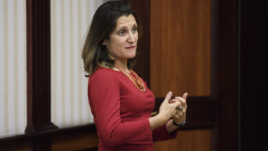
Geographic information systems, or GIS, has transformed the way Clearwater Seafoods fishes, said Jim Mosher, the company’s director of harvest science.
Ocean mapping reduced the fuel bill in its offshore lobster fishery by shaving nearly 10,000 kilometres a year in vessel transiting, or movement in the fishing ground, he said.
In the scallop fishery, this technology reveals areas that should be closed because scallops are too young to harvest.
The company can rotate where it fishes to allow stocks to recover, much like a fallow field in farming.
Gatherers not hunters
“Years ago, we chose to move our business from hunters to gatherers,” said Mosher.
“We don’t want to go out and hunt. It’s extremely expensive and it’s not the best for the environment or for the resource.”
Mosher and other company officials talked about the use of ocean mapping and other technologies at the conference held by Esri, a California developer of GIS software.
iPads with apps that record every tow and every catch are now standard equipment on the bridges of Clearwater’s Canadian fleet, and captains and officers are trained how to use them.
In the scallop fishery off southern Nova Scotia, Clearwater uses a video survey to count and measure individual scallops and then uses statistical analysis to estimate densities. The result is fed into and becomes part of an ocean map, indicating the age, size and location of scallops.
Technology also reveals fishing intensity so the same area is not fished twice.
“When we find an aggregation of juvenile scallops, we close that area jointly with the rest of the industry on a volunteer basis, without DFO involved, and we allow those scallops to grow and mature,” said Mosher.
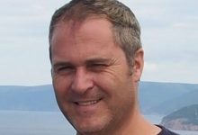
Clearwater is funding research by scientist Craig Brown, a specialist in sea-floor habitat mapping at the Nova Scotia Community College.
Brown said high-resolution imagery produced by multibeam echosounders reveal the geology of the ocean floor in incredible detail and provide the likely habitat for individual species.
That’s vital information for fishing companies like Clearwater, but also for the Department of Fisheries and Oceans, which regulates them.
“What we can do with these new technologies is take the data, we ground validate often with video sets. We will go out and observe where, say, scallops are on the ocean floor and if we know where all that is, we take it into a GIS platform and we can model suitability of habitat over these areas,” said Brown.
Climate change the next frontier
Both Brown and Mosher see better understanding ocean climate change as the next frontier for GIS.
“We can statistically model things like ocean currents. We can look at shifts in temperature over larger spatial scales and we can start to model and try and understand what effect that’s going to have on the sea floor ecosystems,” said Brown.
Harvest species are affected by warming temperatures and acidity or PH levels that are changing because carbon dioxide from the atmosphere is being absorbed in the ocean.
Mosher said carbonate-base shellfish such as scallops and clams are sensitive to increased acidity.
“They end up putting more energy into building their shells rather than building their muscles,” he said. “This is looming. We know its coming. We are doing work with our academic partners in order to understand that better. And we have some research themes on the books right now to understand that sort of thing.”
Esri ocean manager Drew Stephens said GIS technology can connect ocean sensors that are collecting data separately through apps and integrate it into a larger system.
“We can look around at PH all over the world at the same time and maybe compare that with the PH last year in a certain area,” he said.
Integrating devices in the ocean “is a big deal and I think we’ve just gotten started,” he said.
An awkward conviction
While Clearwater said GIS has increased sustainability, it has not always practised what it preaches.
In September 2018, the company was convicted of a “gross violation” in its offshore lobster for storing thousands of unbaited, disabled traps on the ocean floor after being expressly warned to stop the practice by the Department of Fisheries and Oceans.
The company said the practice has ended.
Clearwater will find out later this month whether the conviction has any impact on its MSC eco-sustainability certification.


Redes Sociais - Comentários